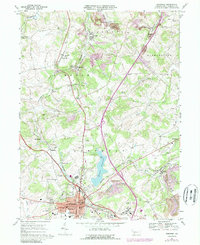
1967 Map of Somerset
USGS Topo · Published 1989About this map
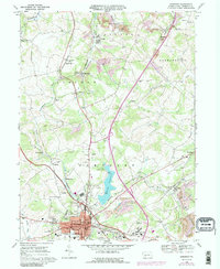
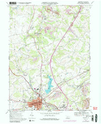
The borough of Somerset serves as the central hub of this 1967 landscape, where the Pennsylvania Turnpike and the Baltimore and Ohio railroad intersect. The map illustrates a region transitioning from rural agrarian roots to modern infrastructure, evidenced by the expansive grounds of the Somerset State Hospital and the nearby Somerset County Airport. To the north, the terrain is shaped by the winding Quemahoning Creek and its tributaries, supporting smaller settlements like Acosta, Sipesville, and Quecreek.
Find a feature on this map
59 named features on this map. Tap any name to fly to it.
Don’t see what you’re looking for? This feature index may not catch every label — zoom into the map to look around manually.
Map Details
Editions of this 1967 Somerset Map
6 editions found
Other maps of this area

1913 · Somerset
USGS Topo · 1:62,500

1914 · Windber
USGS Topo · 1:62,500

1915 · Somerset
USGS Topo · 1:62,500

1916 · Windber
USGS Topo · 1:62,500

1921 · Meyersdale
USGS Topo · 1:62,500

1923 · Berlin
USGS Topo · 1:48,000

1929 · Berlin
USGS Topo · 1:62,500

1939 · Meyersdale
USGS Topo · 1:62,500

1944 · Somerset
USGS Topo · 1:62,500

1944 · Windber
USGS Topo · 1:62,500
Featured Places
- Somerset, PA
- Quemahoning Township, PA
- Jenner Township, PA
- Somerset Township, PA
- Ralphton, Quemahoning Township