
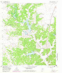
1964 Map of Sonora NW
USGS Topo · Published 1966About this map
The Devils River winds through the Edwards Plateau in this mid-1960s study of the Schleicher and Sutton county line. The landscape is defined by the development of the Gas Field and a series of flood control structures identified as Site No 2 through Site No 7. This era of land use is characterized by large private holdings and natural resource extraction, with a network of pipelines and gravel pits supporting local infrastructure. Family ranching legacies are central to the settlement pattern, anchored by the Nixon Ranch, Jones Ranch, and Meckel Ranch. These sites represent the traditional cattle and sheep operations that have historically sustained the regional economy, while the transition toward energy production is evidenced by the numerous gas wells and the Pumping Sta located near De Berry Ranch.
Find a feature on this map
24 named features on this map. Tap any name to fly to it.
Don’t see what you’re looking for? This feature index may not catch every label — zoom into the map to look around manually.
Map Details
Editions of this 1964 Sonora NW Map
2 editions found
Other maps of this area

1954 · Sonora
USGS Topo · 1:250,000

1958 · Sonora
USGS Topo · 1:250,000

1964 · Sonora
USGS Topo · 1:24,000

1964 · Sonora SE
USGS Topo · 1:24,000

1964 · Sonora NE
USGS Topo · 1:24,000

1964 · Eldorado SW
USGS Topo · 1:24,000

1964 · Coupe Ranch
USGS Topo · 1:24,000
1964 · Eldorado
USGS Topo · 1:24,000

1967 · Savell Ranch
USGS Topo · 1:24,000

1967 · Caverns Of Sonora
USGS Topo · 1:24,000