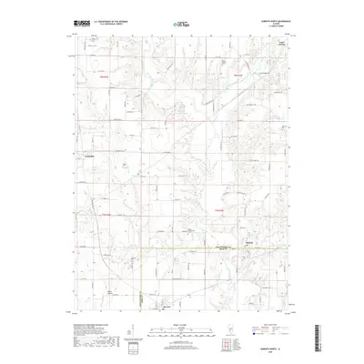
2018 Map of Sorento North
USGS Topo · Published 2018About this map
Taylor Springs and the village of Panama anchor this agricultural landscape along the border of Montgomery and Bond counties. The terrain is defined by the winding paths of Shoal Creek and its many tributaries, including Waveland Cr and West Fork Shoal Creek, which cut through the level fields. Local history is deeply etched into the land through numerous rural burying grounds such as Rankin Presbyterian Cem and Kirkland Cem, suggesting the locations of early congregations and family homesteads. Near the southern edge, the town of Sorento sits just below the county line, while the prominent rise of Robbs Mound stands out as a rare topographical landmark in the southwest. A dense network of named rural roads, such as Walshville Trl and Barry Hope Trl, connects these small communities and isolated farmsteads.
Find a feature on this map
103 named features on this map. Tap any name to fly to it.
Don’t see what you’re looking for? This feature index may not catch every label — zoom into the map to look around manually.
Map Details
Editions of this 2018 Sorento North Map
This is the sole edition of this map. No revisions or reprints were ever made.
Other maps of this area

1915 · Mount Olive
USGS Topo · 1:62,500

1932 · Greenville
USGS Topo · 1:62,500

1937 · New Douglas
USGS Topo · 1:48,000

1939 · Greenville
USGS Topo · 1:62,500

1943 · Greenville
USGS Topo · 1:62,500

1944 · New Douglas
USGS Topo · 1:62,500

1944 · Mount Olive
USGS Topo · 1:62,500

1947 · Hillsboro
USGS Topo · 1:62,500

1949 · Hillsboro
USGS Topo · 1:62,500

1958 · Decatur
USGS Topo · 1:250,000