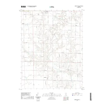
2021 Map of Sorento South
USGS Topo · Published 2021About this map
Shoal Creek meanders through the heart of this Bond County landscape, defining the topography between the small communities of Sorento and Old Ripley. The area is characterized by a high density of rural burial sites, such as New Mount Nebo Cem, Reno Bethel Cem, and Tisdale Cem, which serve as vital markers for local genealogists tracing family histories in the region. The map captures the interface between traditional agricultural plots and local infrastructure, including the Sorento Reservoir and the small airfield at Nance Airport. Settlements like Bunje, Reno, and Gilmore are linked by a network of rural roads such as Ripson Bridge Ave and Baumberger Ave. The drainage patterns of Dry Fork and Little Silver Cr reveal the natural dissection of the Illinois prairie, providing a detailed record of the land as it remains managed for both utility and community memory.
Find a feature on this map
48 named features on this map. Tap any name to fly to it.
Don’t see what you’re looking for? This feature index may not catch every label — zoom into the map to look around manually.
Map Details
Editions of this 2021 Sorento South Map
This is the sole edition of this map. No revisions or reprints were ever made.
Other maps of this area

1915 · Mount Olive
USGS Topo · 1:62,500

1932 · Greenville
USGS Topo · 1:62,500

1937 · New Douglas
USGS Topo · 1:48,000

1939 · Greenville
USGS Topo · 1:62,500

1943 · Greenville
USGS Topo · 1:62,500

1944 · New Douglas
USGS Topo · 1:62,500

1944 · Mount Olive
USGS Topo · 1:62,500

1947 · Hillsboro
USGS Topo · 1:62,500

1949 · Hillsboro
USGS Topo · 1:62,500

1958 · Decatur
USGS Topo · 1:250,000