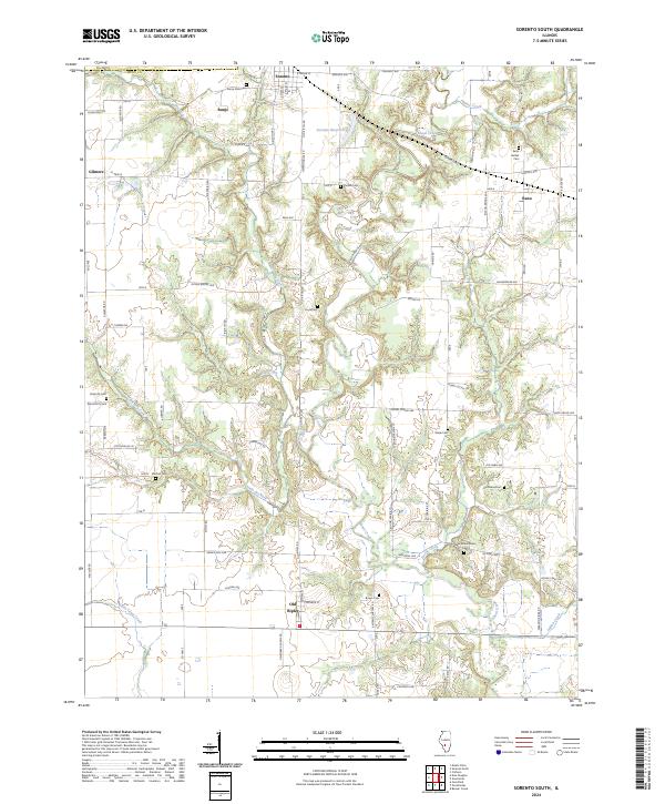
2024 Map of Sorento South
USGS Topo · Published 2024About this map
Shoal Creek and its many tributaries, including Dorris Creek, Flat Creek, and the Little Dry Fork, carve a dendritic drainage pattern across this Bond County landscape. The village of Sorento sits at the northern edge, supported by the Sorento Reservoir, while smaller settlements like Reno, Bunje, and Old Ripley anchor the surrounding rural road network. The map reveals a high density of burial grounds, suggesting deep generational roots in the area; researchers can find the New Mount Nebo Cem, Old Nebo Cem, and several family-named plots such as Coyle Cem and Peterson Cem. Most of these sites are situated on the higher ground between the creek beds, connected by a grid of numbered township roads and named avenues like Sorento Ave and Ripson Bridge Ave.
Find a feature on this map
82 named features on this map. Tap any name to fly to it.
Don’t see what you’re looking for? This feature index may not catch every label — zoom into the map to look around manually.
Map Details
Editions of this 2024 Sorento South Map
This is the sole edition of this map. No revisions or reprints were ever made.
Other maps of this area

1915 · Mount Olive
USGS Topo · 1:62,500

1932 · Greenville
USGS Topo · 1:62,500

1937 · New Douglas
USGS Topo · 1:48,000

1939 · Greenville
USGS Topo · 1:62,500

1943 · Greenville
USGS Topo · 1:62,500

1944 · New Douglas
USGS Topo · 1:62,500

1944 · Mount Olive
USGS Topo · 1:62,500

1947 · Hillsboro
USGS Topo · 1:62,500

1949 · Hillsboro
USGS Topo · 1:62,500

1958 · Decatur
USGS Topo · 1:250,000