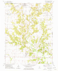
1974 Map of Sorento South
USGS Topo · Published 1977About this map
Shoal Creek dominates this Illinois landscape, winding through a network of smaller tributaries including Dry Fork, Yankee Creek, and Dorris Creek. The terrain reveals a rural economy shaped by both agriculture and industry, with several Oil Wells and a Claypit near Gilmore marking local resource extraction. Transport is defined by the intersection of rail lines, notably the Norfolk And Western and the Burlington Northern, which support the small communities of Sorento and Reno. Numerous family-named cemeteries such as Coyle Cem, Tisdale Cem, and Wade Cem are scattered across the township, providing a detailed record of the families who settled this portion of Bond County and Montgomery County during the mid-20th century.
Find a feature on this map
36 named features on this map. Tap any name to fly to it.
Don’t see what you’re looking for? This feature index may not catch every label — zoom into the map to look around manually.
Map Details
Editions of this 1974 Sorento South Map
This is the sole edition of this map. No revisions or reprints were ever made.
Other maps of this area

1915 · Mount Olive
USGS Topo · 1:62,500

1932 · Greenville
USGS Topo · 1:62,500

1937 · New Douglas
USGS Topo · 1:48,000

1939 · Greenville
USGS Topo · 1:62,500

1943 · Greenville
USGS Topo · 1:62,500

1944 · New Douglas
USGS Topo · 1:62,500

1944 · Mount Olive
USGS Topo · 1:62,500

1947 · Hillsboro
USGS Topo · 1:62,500

1949 · Hillsboro
USGS Topo · 1:62,500

1958 · Decatur
USGS Topo · 1:250,000