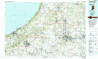
1983 Map of South Bend
USGS Topo · Published 1991About this map
South Bend and its industrial corridor are established here alongside the winding St Joseph River, anchoring a cross-border region of northern Indiana and southern Michigan. The map highlights a significant concentration of educational institutions, including the University of Notre Dame, St Marys College, and Bethel College, while Andrews University lies further north. Along the shoreline of Lake Michigan, the Indiana Dunes National Lakeshore protects a landscape of high dunes like Mount Tom and Mount Baldy. Further inland, the transportation network is defined by the Indiana Toll Road and various lines of the Conrail and Grand Trunk Western RR. The southern portion reveals the vast wetlands of the Kankakee State Fish and Wildlife Area, illustrating the transition from dense urban centers like Mishawaka and Elkhart to significant conservation lands.
Find a feature on this map
226 named features on this map. Tap any name to fly to it.
Don’t see what you’re looking for? This feature index may not catch every label — zoom into the map to look around manually.
Map Details
Editions of this 1983 South Bend Map
2 editions found
Other maps of this area

1927 · Niles
USGS Topo · 1:62,500

1927 · Hartford
USGS Topo · 1:62,500

1927 · Benton Harbor
USGS Topo · 1:62,500

1930 · Three Oaks
USGS Topo · 1:62,500

1930 · Benton Harbor
USGS Topo · 1:62,500

1930 · Niles
USGS Topo · 1:62,500

1931 · Hartford
USGS Topo · 1:62,500

1934 · Porter
USGS Topo · 1:48,000

1940 · Porter
USGS Topo · 1:62,500

1943 · Niles
USGS Topo · 1:62,500