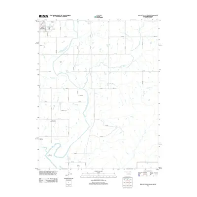
2013 Map of South Coffeyville
USGS Topo · Published 2013About this map
South Coffeyville anchors the northwest corner of this 2013 survey, where a strict grid of streets including Walnut St and Etchen Blvd sits just south of the state line. The landscape is defined by the winding path of the Verdigris River, which carves deep meanders like the prominent Goose Neck Bend through the center of the quadrangle. This riparian corridor is flanked by several oxbow features and small bodies of water, such as Chouteau Lake and Goose Neck Lake, illustrating the river's historical shifts across the floodplain.
Find a feature on this map
53 named features on this map. Tap any name to fly to it.
Don’t see what you’re looking for? This feature index may not catch every label — zoom into the map to look around manually.
Map Details
Editions of this 2013 South Coffeyville Map
This is the sole edition of this map. No revisions or reprints were ever made.
Other maps of this area

1886 · Independence
USGS Topo · 1:125,000

1886 · Parsons
USGS Topo · 1:125,000

1893 · Parsons
USGS Topo · 1:125,000

1894 · Independence
USGS Topo · 1:125,000

1901 · Nowata
USGS Topo · 1:125,000

1901 · Vinita
USGS Topo · 1:125,000

1905 · Independence
USGS Topo · 1:125,000

1913 · Vinita
USGS Topo · 1:125,000

1914 · Nowata
USGS Topo · 1:125,000

1946 · Mound Valley
USGS Topo · 1:62,500