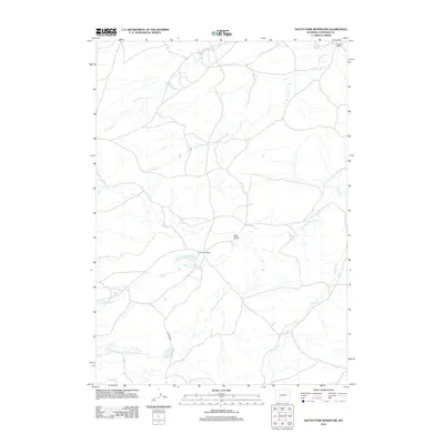
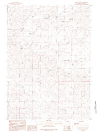
2012 Map of South Fork Reservoir
USGS Topo · Published 2012About this map
Eskew Number 2 Reservoir and its surrounding drainage systems define this section of Converse County in the early 21st century. The landscape is characterized by a network of intermittent watercourses, including the Dry Fork Cheyenne River and the Middle Fork Dry Fork Cheyenne River. Ranching operations are the primary human imprint on the land, evidenced by Fifty-five Ranch and Patterson Ranch in the northeast. Transportation is limited to a sparse network of rural routes such as 55 Ranch Rd, which provides access through the arid terrain near Pine Gulch. The complex hydrology of the region is further mapped through the winding paths of N Fork Bear Cr, S Fork Bear Cr, and Phillips Cr, showing how water management and natural creek beds dictate the placement of local homesteads.
Find a feature on this map
10 named features on this map. Tap any name to fly to it.
Don’t see what you’re looking for? This feature index may not catch every label — zoom into the map to look around manually.
Map Details
Editions of this 2012 South Fork Reservoir Map
This is the sole edition of this map. No revisions or reprints were ever made.
Other maps of this area

1955 · Newcastle
USGS Topo · 1:250,000

1958 · Newcastle
USGS Topo · 1:250,000

1959 · Fifty-Five Ranch
USGS Topo · 1:62,500

1959 · Coal Draw
USGS Topo · 1:62,500
1959 · Highland Flats
USGS Topo · 1:62,500

1960 · Ross
USGS Topo · 1:62,500

1979 · Bill
USGS Topo · 1:100,000
1984 · Marsh Draw
USGS Topo · 1:24,000
1984 · Gumbo Hill
USGS Topo · 1:24,000
1984 · Holdup Hollow
USGS Topo · 1:24,000