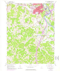
1961 Map of South Parkersburg
USGS Topo · Published 1976About this map
South Parkersburg and the surrounding reaches of the Little Kanawha River reflect a landscape of transition between mid-century industrial growth and the deeply dissected ridges of Wood County. The industrial presence of the Baltimore and Ohio railroad corridor anchors the urban expansion south of the city, while the rural interior is characterized by family-named ridges and hollows, such as Homewood Ridge and Boga Ridge. The map documents a dense network of local landmarks, including the Gihon Ch and numerous small family burial grounds like the Butcher Cem and Stephens Cem.
Find a feature on this map
105 named features on this map. Tap any name to fly to it.
Don’t see what you’re looking for? This feature index may not catch every label — zoom into the map to look around manually.
Map Details
Editions of this 1961 South Parkersburg Map
3 editions found
Other maps of this area

1902 · Parkersburg
USGS Topo · 1:62,500

1904 · Parkersburg
USGS Topo · 1:62,500

1904 · Marietta
USGS Topo · 1:62,500

1906 · Elizabeth
USGS Topo · 1:62,500

1906 · Belleville
USGS Topo · 1:62,500

1924 · Belleville
USGS Topo · 1:62,500

1924 · Marietta
USGS Topo · 1:62,500

1924 · Elizabeth
USGS Topo · 1:62,500

1926 · Elizabeth
USGS Topo · 1:62,500

1926 · Belleville
USGS Topo · 1:62,500