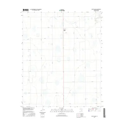
2016 Map of South Plains
USGS Topo · Published 2016About this map
South Plains serves as the central hub of this agricultural landscape in Floyd County, where the high plains meet the headwaters of Quitaque Cr. The map captures a transition in topography as the flat tablelands of the Llano Estacado drop into the more complex drainage of the creek in the northeast. The community structure is anchored by Edwards St and the local Po, surrounded by an extensive network of county roads that define the rural property lines. Transport and connectivity are provided by Fm 2286 and Fm 97, linking the isolated farmsteads and field operations to the larger regional economy. This survey details a landscape dominated by seasonal wetlands and playas, common to the Texas South Plains, which provide critical ecological function amidst the vast acreage of industrial-scale farming.
Find a feature on this map
21 named features on this map. Tap any name to fly to it.
Don’t see what you’re looking for? This feature index may not catch every label — zoom into the map to look around manually.
Map Details
Editions of this 2016 South Plains Map
This is the sole edition of this map. No revisions or reprints were ever made.
Other maps of this area

1954 · Plainview
USGS Topo · 1:250,000

1958 · Plainview
USGS Topo · 1:250,000

1965 · Whiteley
USGS Topo · 1:24,000

1965 · Lockney SE
USGS Topo · 1:24,000

1965 · Silverton SW
USGS Topo · 1:24,000

1965 · Lockney
USGS Topo · 1:24,000

1966 · Sterley
USGS Topo · 1:24,000

1966 · South Plains
USGS Topo · 1:24,000

1966 · Lockney 4 SW
USGS Topo · 1:24,000

1967 · Edgemon Lake
USGS Topo · 1:24,000