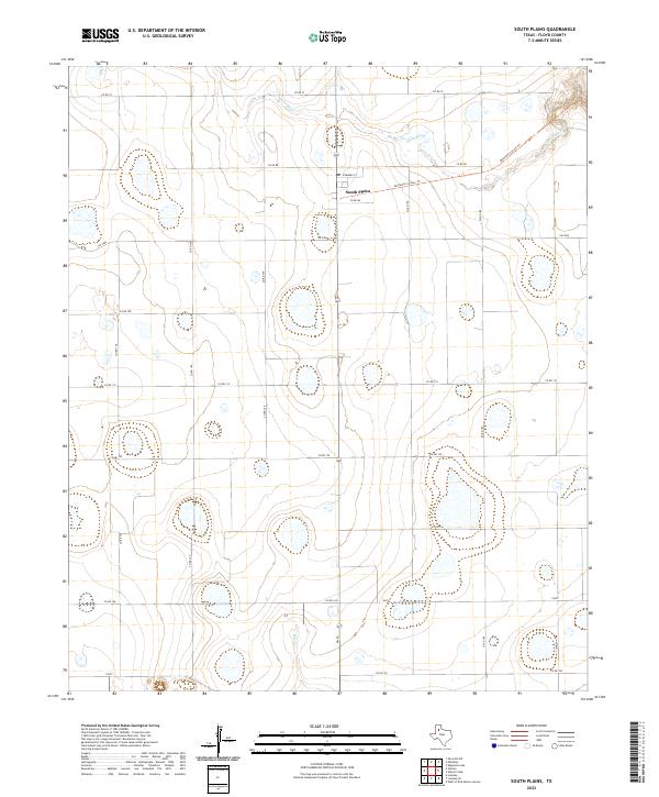
2022 Map of South Plains
USGS Topo · Published 2022About this map
South Plains serves as the central hub of this agricultural landscape in Floyd County, where the high plains terrain is defined by a grid of rural roads and scattered playa lakes. The settlement is anchored by Edwards St and sits at the intersection of several farm-to-market routes and county roads. To the north and east, the geography shifts dramatically as the headwaters of Quitaque Cr begin to carve into the plains, eventually leading toward the Quitaque Canyon Trl. This area illustrates the transition from the flat, cultivated Llano Estacado into the rugged breaks of the Caprock. The map's layout of Co Rd 80 and FM 2286 highlights a community built around large-scale cotton and grain farming, where seasonal water features and canyon transitions dictate the local infrastructure.
Find a feature on this map
21 named features on this map. Tap any name to fly to it.
Don’t see what you’re looking for? This feature index may not catch every label — zoom into the map to look around manually.
Map Details
Editions of this 2022 South Plains Map
This is the sole edition of this map. No revisions or reprints were ever made.
Other maps of this area

1954 · Plainview
USGS Topo · 1:250,000

1958 · Plainview
USGS Topo · 1:250,000

1965 · Whiteley
USGS Topo · 1:24,000

1965 · Lockney SE
USGS Topo · 1:24,000

1965 · Silverton SW
USGS Topo · 1:24,000

1965 · Lockney
USGS Topo · 1:24,000

1966 · Sterley
USGS Topo · 1:24,000

1966 · South Plains
USGS Topo · 1:24,000

1966 · Lockney 4 SW
USGS Topo · 1:24,000

1967 · Edgemon Lake
USGS Topo · 1:24,000