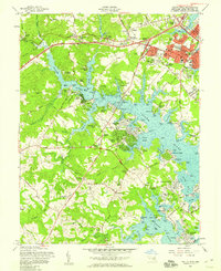
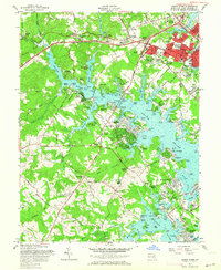
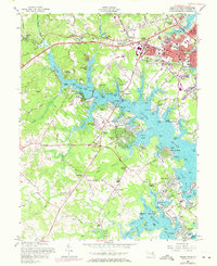
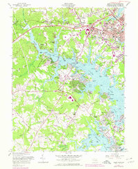
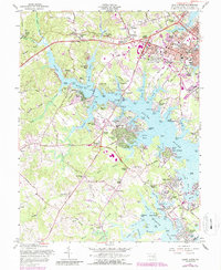
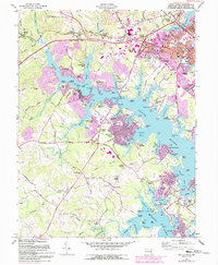
1957 Map of South River
USGS Topo · Published 1958About this map
The tidal estuary of the South River dominates this mid-century survey, illustrating the suburban expansion and maritime character surrounding Annapolis during the late 1950s. The map captures the city's southwestern fringe, including West Annapolis and the developing residential clusters of Parole and Admiral Heights. This era of transition is evident in the landscape, where an abandoned reservoir near Oak Court sits in contrast to the modern footprint of the Drive-in Theater and the broadcast presence of Radio Towers (WNAV).
Find a feature on this map
149 named features on this map. Tap any name to fly to it.
Don’t see what you’re looking for? This feature index may not catch every label — zoom into the map to look around manually.
Map Details
Editions of this 1957 South River Map
6 editions found
Other maps of this area

1892 · Owensville
USGS Topo · 1:62,500

1892 · Annapolis
USGS Topo · 1:62,500

1893 · North Point
USGS Topo · 1:62,500

1894 · Relay
USGS Topo · 1:62,500

1895 · Owensville
USGS Topo · 1:62,500

1898 · Choptank
USGS Topo · 1:125,000

1898 · Tolchester
USGS Topo · 1:125,000

1899 · Patuxent
USGS Topo · 1:125,000

1903 · Tolchester
USGS Topo · 1:125,000

1904 · North Point
USGS Topo · 1:62,500