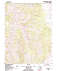
1981 Map of South Schell Peak
USGS Topo · Published 1994About this map
Schell Range dominates this landscape, where the high ridges of South Schell Peak and Taft Peak rise above the drainage networks of the Humboldt National Forest. The map documents a rugged wilderness terrain defined by deep canyons and high-altitude water sources like Pete Spring and North Cleve Spring. While largely undeveloped, human activity is marked by a scattered Prospect near the northeast corner and a series of Pack Trails and 4wd roads that follow the contours of the mountains. An Aqueduct on the eastern slopes indicates the strategic movement of water from the mountain creeks toward the floor of Spring Valley. The complex hydrology of the region is evident in the numerous tributaries, including Stephens Creek, Vipont Creek, and Freehill Creek, which feed into the larger basins below the peaks.
Find a feature on this map
29 named features on this map. Tap any name to fly to it.
Don’t see what you’re looking for? This feature index may not catch every label — zoom into the map to look around manually.
Map Details
Editions of this 1981 South Schell Peak Map
2 editions found
Other maps of this area

1952 · Ely
USGS Topo · 1:125,000

1956 · Ely
USGS Topo · 1:250,000

1959 · Ely
USGS Topo · 1:250,000

1959 · Sacramento Pass
USGS Topo · 1:62,500

1959 · Connors Pass
USGS Topo · 1:62,500

1959 · Schell Peaks
USGS Topo · 1:62,500

1963 · Ely
USGS Topo · 1:250,000

1981 · North Schell Peak
USGS Topo · 1:24,000

1981 · Duck Creek Valley
USGS Topo · 1:24,000
1981 · South Schell Peak
USGS Topo · 1:24,000