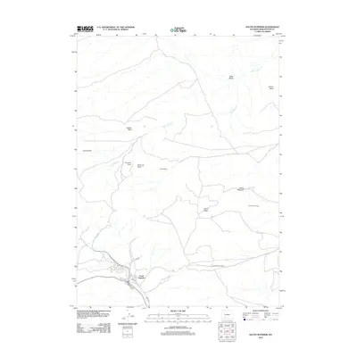
2012 Map of South Superior
USGS Topo · Published 2012About this map
South Superior anchor the southern edge of this high-desert landscape in Sweetwater County, where the street grid of the town site transitions into a complex series of geological formations. The terrain is defined by volcanic and sedimentary features, most notably the Leucite Hills and a series of prominent elevations including Hatcher Mesa, Emmons Mesa, and the volcanic Emmons Cone. The map illustrates a sparse settlement pattern characteristic of the Wyoming interior, marked by the presence of the Gornik Ranch and the distinctive geological formation known as The Natural Corrals. Critical water sources in this arid environment are carefully recorded, including UP Spring, Table Wash, and the winding course of Black Rock Cr. Regional connectivity is maintained through several named thoroughfares such as Park Rd and the Superior Cutoff Rd, which connect the town to the surrounding basins and meadows.
Find a feature on this map
22 named features on this map. Tap any name to fly to it.
Don’t see what you’re looking for? This feature index may not catch every label — zoom into the map to look around manually.
Map Details
Editions of this 2012 South Superior Map
This is the sole edition of this map. No revisions or reprints were ever made.
Other maps of this area

1908 · Rock Springs
USGS Topo · 1:62,500

1910 · Rock Springs
USGS Topo · 1:62,500

1954 · Rock Springs
USGS Topo · 1:250,000

1958 · Rock Springs
USGS Topo · 1:250,000

1958 · Boars Tusk
USGS Topo · 1:62,500

1958 · Superior
USGS Topo · 1:62,500

1962 · Rock Springs
USGS Topo · 1:250,000

1968 · North Baxter
USGS Topo · 1:24,000

1968 · Point Of Rocks
USGS Topo · 1:24,000
1968 · Thayer Junction
USGS Topo · 1:24,000