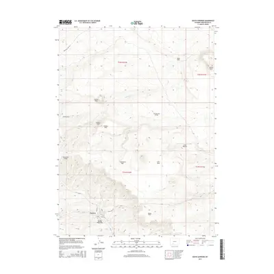
2015 Map of South Superior
USGS Topo · Published 2015About this map
Superior and South Superior anchor the southwestern corner of this landscape, where local streets like Hill St and Berta St provide a glimpse into the community's layout. The terrain is defined by the high elevations of the Leucite Hills and a series of prominent mesas, including Hatcher Mesa, Emmons Mesa, and Zirkel Mesa. This area is a significant geographical crossroads, marked by the presence of the Continental Divide winding through the central portion of the quadrangle.
Find a feature on this map
28 named features on this map. Tap any name to fly to it.
Don’t see what you’re looking for? This feature index may not catch every label — zoom into the map to look around manually.
Map Details
Editions of this 2015 South Superior Map
This is the sole edition of this map. No revisions or reprints were ever made.
Other maps of this area

1908 · Rock Springs
USGS Topo · 1:62,500

1910 · Rock Springs
USGS Topo · 1:62,500

1954 · Rock Springs
USGS Topo · 1:250,000

1958 · Rock Springs
USGS Topo · 1:250,000

1958 · Boars Tusk
USGS Topo · 1:62,500

1958 · Superior
USGS Topo · 1:62,500

1962 · Rock Springs
USGS Topo · 1:250,000

1968 · North Baxter
USGS Topo · 1:24,000

1968 · Point Of Rocks
USGS Topo · 1:24,000
1968 · Thayer Junction
USGS Topo · 1:24,000