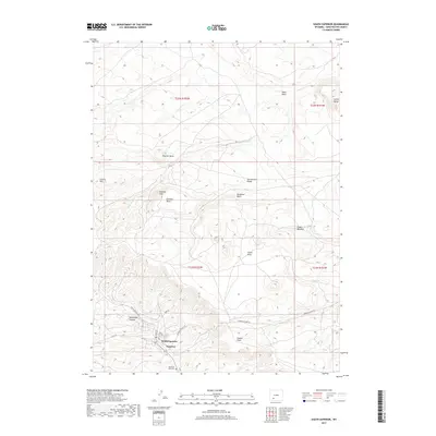
2017 Map of South Superior
USGS Topo · Published 2017About this map
South Superior and Superior serve as the primary human settlements in this arid high-altitude landscape of Sweetwater County, Wyoming. The terrain is defined by dramatic geological features such as Hatcher Mesa, Leucite Hills, and the Continental Divide, which traverses the central portion of the map. Traces of local history are evident in the naming of physical landmarks like Emmons Cone and Zirkel Mesa, while Horsethief Canyon hints at the region's colorful frontier past.
Find a feature on this map
26 named features on this map. Tap any name to fly to it.
Don’t see what you’re looking for? This feature index may not catch every label — zoom into the map to look around manually.
Map Details
Editions of this 2017 South Superior Map
This is the sole edition of this map. No revisions or reprints were ever made.
Other maps of this area

1908 · Rock Springs
USGS Topo · 1:62,500

1910 · Rock Springs
USGS Topo · 1:62,500

1954 · Rock Springs
USGS Topo · 1:250,000

1958 · Rock Springs
USGS Topo · 1:250,000

1958 · Boars Tusk
USGS Topo · 1:62,500

1958 · Superior
USGS Topo · 1:62,500

1962 · Rock Springs
USGS Topo · 1:250,000

1968 · North Baxter
USGS Topo · 1:24,000

1968 · Point Of Rocks
USGS Topo · 1:24,000
1968 · Thayer Junction
USGS Topo · 1:24,000