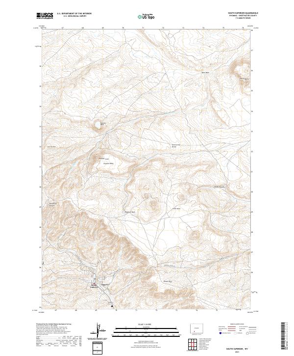
2021 Map of South Superior
USGS Topo · Published 2021About this map
The town of South Superior and the adjacent settlement of Superior anchor the southern edge of this landscape, situated at the base of a complex network of high mesas and arid washes. This area is characterized by the high elevations of the Continental Divide, which traverses the center of the sheet among geological features like Emmons Mesa, Zirkel Mesa, and Hatcher Mesa. Local genealogy researchers can find the Mountain View Cem located just south of the main residential grid, serving the communities that established themselves in this high-desert mining region.
Find a feature on this map
28 named features on this map. Tap any name to fly to it.
Don’t see what you’re looking for? This feature index may not catch every label — zoom into the map to look around manually.
Map Details
Editions of this 2021 South Superior Map
This is the sole edition of this map. No revisions or reprints were ever made.
Other maps of this area

1908 · Rock Springs
USGS Topo · 1:62,500

1910 · Rock Springs
USGS Topo · 1:62,500

1954 · Rock Springs
USGS Topo · 1:250,000

1958 · Rock Springs
USGS Topo · 1:250,000

1958 · Boars Tusk
USGS Topo · 1:62,500

1958 · Superior
USGS Topo · 1:62,500

1962 · Rock Springs
USGS Topo · 1:250,000

1968 · North Baxter
USGS Topo · 1:24,000

1968 · Point Of Rocks
USGS Topo · 1:24,000
1968 · Thayer Junction
USGS Topo · 1:24,000