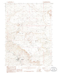
1986 Map of South Superior
USGS Topo · Published 1986About this map
South Superior, also identified by its post office as Superior P O, occupies a dramatic position at the edge of Horsethief Canyon. This 1986 record of the Sweetwater County landscape highlights the intersection of high-desert terrain and the Continental Divide, which traverses the northeastern portion of the sheet. The area is defined by volcanic features and high plateaus, including Zirkel Mesa and the Pumice Hills, suggesting a region shaped by both geological forces and intermittent ranching or mineral interests. Numerous labels for Prospect and Mine appear across the volcanic mesas, while natural landmarks like The Natural Corrals and Scotts Meadow provide points of reference in an otherwise arid expanse drained by Deadman Wash and Leucite Creek.
Find a feature on this map
25 named features on this map. Tap any name to fly to it.
Don’t see what you’re looking for? This feature index may not catch every label — zoom into the map to look around manually.
Map Details
Editions of this 1986 South Superior Map
This is the sole edition of this map. No revisions or reprints were ever made.
Other maps of this area

1908 · Rock Springs
USGS Topo · 1:62,500

1910 · Rock Springs
USGS Topo · 1:62,500

1954 · Rock Springs
USGS Topo · 1:250,000

1958 · Rock Springs
USGS Topo · 1:250,000

1958 · Boars Tusk
USGS Topo · 1:62,500

1958 · Superior
USGS Topo · 1:62,500

1962 · Rock Springs
USGS Topo · 1:250,000

1968 · North Baxter
USGS Topo · 1:24,000

1968 · Point Of Rocks
USGS Topo · 1:24,000
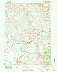
1968 · Thayer Junction
USGS Topo · 1:24,000