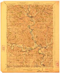
1923 Map of South Wayne
USGS Topo · Published 1923About this map
The East Branch Pecatonica River and the main Pecatonica River dominate this 1921 survey, creating a landscape defined by deep valleys and agricultural plateaus along the Wisconsin and Illinois border. At the center of this drainage system lies South Wayne, a critical junction for the Chicago Milwaukee and St Paul railroad. Further north, the village of Argyle sits at the confluence of the Yellowstone River and the East Branch, serving as a secondary hub for the Illinois Central rail line.
Find a feature on this map
85 named features on this map. Tap any name to fly to it.
Don’t see what you’re looking for? This feature index may not catch every label — zoom into the map to look around manually.
Map Details
Editions of this 1923 South Wayne Map
3 editions found
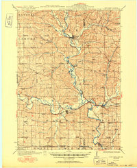
Other maps of this area

1902 · Mineral Point
USGS Topo · 1:125,000

1911 · Elizabeth
USGS Topo · 1:62,500

1920 · Monroe
USGS Topo · 1:62,500

1922 · Monroe
USGS Topo · 1:62,500

1923 · Blanchardville
USGS Topo · 1:62,500

1923 · New Glarus
USGS Topo · 1:62,500

1923 · South Wayne
USGS Topo · 1:62,500

1936 · Elizabeth
USGS Topo · 1:62,500

1937 · Lena
USGS Topo · 1:48,000

1939 · Freeport
USGS Topo · 1:48,000