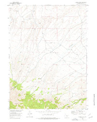
1953 Map of Spanish Mine
USGS Topo · Published 1977About this map
The Ferris Mountains dominate the southern landscape of this mid-century survey, rising sharply above the complex drainage systems of the Arkansas Basin. This area of Carbon County is defined by its water resources and mineral prospects, featuring the Spanish Mine and the seasonal flows of Rush Creek and Arkansas Creek. The high-altitude terrain is marked by a network of ditches and springs, including the specifically named Jimmys Place, which suggests a localized human footprint in an otherwise vast expanse of rangeland. The map detail highlights the geographic transition from the flatlands of Arkansas Flats to the steep relief of Pole Canyon and Miners Canyon, providing a clear record of the territory as it appeared during the development of the Missouri River Basin project.
Find a feature on this map
14 named features on this map. Tap any name to fly to it.
Don’t see what you’re looking for? This feature index may not catch every label — zoom into the map to look around manually.
Map Details
Editions of this 1953 Spanish Mine Map
3 editions found
Other maps of this area

1951 · Savage Peak
USGS Topo · 1:24,000

1951 · Independence Rock
USGS Topo · 1:24,000

1951 · Fort Ridge
USGS Topo · 1:24,000

1953 · Bradley Peak
USGS Topo · 1:24,000

1953 · Ferris
USGS Topo · 1:24,000

1953 · Buzzard Ranch
USGS Topo · 1:24,000

1953 · Spanish Mine
USGS Topo · 1:24,000

1955 · Casper
USGS Topo · 1:250,000

1958 · Casper
USGS Topo · 1:250,000

1961 · Lamont NE
USGS Topo · 1:24,000