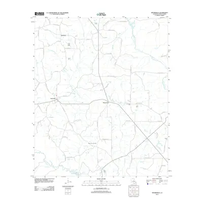
2012 Map of Spearsville
USGS Topo · Published 2012About this map
Spearsville serves as the central hub of this North Louisiana landscape, where the road network branches out to smaller settlements like Taylortown and Mount Union. The terrain is defined by a dense network of tributaries including Tenmile Cr and Bayou de Loutre, which feed south toward the northern reaches of Bayou D'Arbonne Lake. The abundance of local cemeteries, such as Antioch Cem, Fellowship Cem, and Liberty Cem, provides significant value for genealogists tracing families in Union Parish. Rising above the pines and rolling hills, the Spearsville Lookout Tower stands as a notable landmark of the region's forestry heritage. The map also documents long-standing family landholdings and rural landmarks, including the Peter Creek Ranch and numerous small creek crossings that have likely shaped local travel patterns for generations.
Find a feature on this map
86 named features on this map. Tap any name to fly to it.
Don’t see what you’re looking for? This feature index may not catch every label — zoom into the map to look around manually.
Map Details
Editions of this 2012 Spearsville Map
This is the sole edition of this map. No revisions or reprints were ever made.
Other maps of this area

1927 · El Dorado
USGS Topo · 1:62,500

1930 · El Dorado
USGS Topo · 1:62,500

1933 · Strong
USGS Topo · 1:62,500

1937 · Strong
USGS Topo · 1:62,500

1939 · Strong
USGS Topo · 1:62,500

1951 · Bernice
USGS Topo · 1:62,500

1951 · El Dorado
USGS Topo · 1:62,500

1952 · Farmerville
USGS Topo · 1:62,500

1953 · El Dorado
USGS Topo · 1:250,000

1955 · Shreveport
USGS Topo · 1:250,000