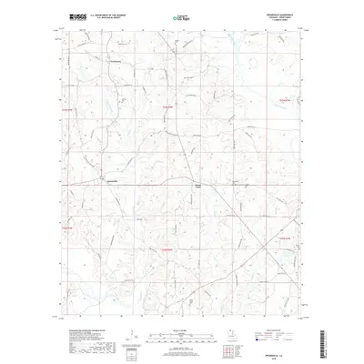
2018 Map of Spearsville
USGS Topo · Published 2018About this map
Spearsville sits as a central hub in this section of Union Parish, where the local road network converges near the intersection of several parish routes. The landscape is defined by its numerous drainages, with Tenmile Cr and Bayou de Loutre carving through the terrain alongside smaller tributaries like Milo Br and Morgan Br. This 2018 survey documents a quiet rural community deeply rooted in its local geography, as evidenced by the high density of family and community burial grounds, including Antioch Cem, Canaan Cem, and the dual sites of Fellowship Cem and Liberty Cem. The northern portion of the map identifies the settlement of Taylortown, while the southeastern corner is marked by Terral Lake and the Beulah Cem. The intricate network of local parish roads, such as Parish Rd 3352 and Burnside Farm Rd, provides insight into the residential and agricultural land use patterns common to this part of northern Louisiana.
Find a feature on this map
84 named features on this map. Tap any name to fly to it.
Don’t see what you’re looking for? This feature index may not catch every label — zoom into the map to look around manually.
Map Details
Editions of this 2018 Spearsville Map
This is the sole edition of this map. No revisions or reprints were ever made.
Other maps of this area

1927 · El Dorado
USGS Topo · 1:62,500

1930 · El Dorado
USGS Topo · 1:62,500

1933 · Strong
USGS Topo · 1:62,500

1937 · Strong
USGS Topo · 1:62,500

1939 · Strong
USGS Topo · 1:62,500

1951 · Bernice
USGS Topo · 1:62,500

1951 · El Dorado
USGS Topo · 1:62,500

1952 · Farmerville
USGS Topo · 1:62,500

1953 · El Dorado
USGS Topo · 1:250,000

1955 · Shreveport
USGS Topo · 1:250,000