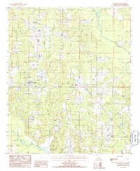
1985 Map of Spearsville
USGS Topo · Published 1986About this map
Spearsville serves as the central hub of this northern Louisiana landscape, situated amidst a dense network of watercourses and timbered terrain. The settlement pattern here is defined by small, clustered communities like Taylortown and Mount Union, connected by a web of local roads that navigate the subtle rises of Resinger Hollis. The area is profoundly shaped by its hydrology, with numerous streams such as Tenmile Creek, Peter Creek, and Mile Branch draining into larger systems like Corney Bayou and Bayou de Loutre.
Find a feature on this map
20 named features on this map. Tap any name to fly to it.
Don’t see what you’re looking for? This feature index may not catch every label — zoom into the map to look around manually.
Map Details
Editions of this 1985 Spearsville Map
This is the sole edition of this map. No revisions or reprints were ever made.
Other maps of this area

1927 · El Dorado
USGS Topo · 1:62,500

1930 · El Dorado
USGS Topo · 1:62,500

1933 · Strong
USGS Topo · 1:62,500

1937 · Strong
USGS Topo · 1:62,500

1939 · Strong
USGS Topo · 1:62,500

1951 · Bernice
USGS Topo · 1:62,500

1951 · El Dorado
USGS Topo · 1:62,500

1952 · Farmerville
USGS Topo · 1:62,500

1953 · El Dorado
USGS Topo · 1:250,000

1955 · Shreveport
USGS Topo · 1:250,000