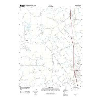
2010 Map of Speed
USGS Topo · Published 2010About this map
Sellersburg and Memphis anchor this portion of Clark County, where the southern Indiana landscape transitions from the residential and industrial corridors along the highway to the more varied terrain of the Knobs. The western edge is defined by the recreational and hydrologic significance of Deam Lake and Deam Lake Dam, while the central region is crossed by the winding course of the Muddy Fork and Indian Creek.
Find a feature on this map
89 named features on this map. Tap any name to fly to it.
Don’t see what you’re looking for? This feature index may not catch every label — zoom into the map to look around manually.
Map Details
Editions of this 2010 Speed Map
This is the sole edition of this map. No revisions or reprints were ever made.
Other maps of this area

1905 · Prospect
USGS Topo · 1:62,500

1912 · Prospect
USGS Topo · 1:62,500

1937 · Jeffersonville
USGS Topo · 1:24,000

1937 · Charlestown
USGS Topo · 1:24,000

1938 · Speed
USGS Topo · 1:24,000

1939 · New Albany
USGS Topo · 1:24,000

1939 · Georgetown
USGS Topo · 1:24,000

1941 · Borden
USGS Topo · 1:24,000

1946 · Jeffersonville
USGS Topo · 1:24,000

1946 · New Albany
USGS Topo · 1:24,000