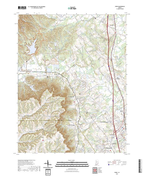
2022 Map of Speed
USGS Topo · Published 2022About this map
Waggoner Knobs and Timer Ridge define the western high ground of this landscape, where the long-distance Knobstone Trl and recreational Clark St Horse-Trails Trl wind through the hills above Deam Lake. The terrain transitions sharply from these wooded heights into the developed lowlands of the Muddy Fork valley, where the historic communities of Bennettsville, Saint Joseph, and Wilson are situated. This area reflects a dense pattern of long-established family landholdings, evidenced by numerous small burial grounds such as Miller Cem, Hickory Grove Cem, and Allen Cem. To the southeast, the urban footprint of Sellersburg and Hamburg expands near the Ivy Tech Community College South Central campus. The eastern edge is dominated by the logistical corridor of the L & I RR and the interstate, connecting the smaller settlements of Memphis and Speed to the growing suburbs of Clarksville.
Find a feature on this map
152 named features on this map. Tap any name to fly to it.
Don’t see what you’re looking for? This feature index may not catch every label — zoom into the map to look around manually.
Map Details
Editions of this 2022 Speed Map
This is the sole edition of this map. No revisions or reprints were ever made.
Other maps of this area

1905 · Prospect
USGS Topo · 1:62,500

1912 · Prospect
USGS Topo · 1:62,500

1937 · Jeffersonville
USGS Topo · 1:24,000

1937 · Charlestown
USGS Topo · 1:24,000

1938 · Speed
USGS Topo · 1:24,000

1939 · New Albany
USGS Topo · 1:24,000

1939 · Georgetown
USGS Topo · 1:24,000

1941 · Borden
USGS Topo · 1:24,000

1946 · Jeffersonville
USGS Topo · 1:24,000

1946 · New Albany
USGS Topo · 1:24,000