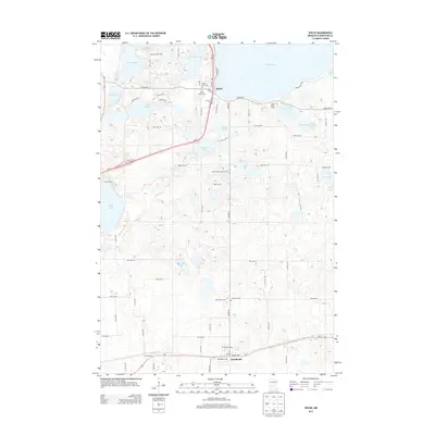
2013 Map of Spicer
USGS Topo · Published 2013About this map
Green Lake and its surrounding wetlands define this landscape in the heart of Minnesota lake country. The town of Spicer serves as a central hub, situated where MN-23 skirts the southern shore of the lake. This area is characterized by an intricate network of water bodies, including Nest Lake, George Lake, and Henderson Lake, interspersed with smaller basins like Elkhorn Lake and Alvig Slough. To the south, the settlement of Kandiyohi anchors the agricultural and transportation corridor along Us-12. The map reveals a high density of small family and community burial sites, such as the Spicer Family Cem, Green Lake Lutheran Cem, and Ebenezer Cem, which offer significant value for genealogists tracing early settlement patterns. This 2013 survey provides a clear view of the established recreational infrastructure, including Decision Hills Camp and Green Lake Camp.
Find a feature on this map
54 named features on this map. Tap any name to fly to it.
Don’t see what you’re looking for? This feature index may not catch every label — zoom into the map to look around manually.
Map Details
Editions of this 2013 Spicer Map
This is the sole edition of this map. No revisions or reprints were ever made.
Other maps of this area

1953 · Saint Cloud
USGS Topo · 1:250,000

1956 · Atwater
USGS Topo · 1:62,500

1957 · Saint Cloud
USGS Topo · 1:250,000

1958 · Saint Cloud
USGS Topo · 1:250,000

1958 · Willmar
USGS Topo · 1:24,000

1958 · Solomon Lake
USGS Topo · 1:24,000

1967 · Mount Tom
USGS Topo · 1:24,000

1967 · Hawick
USGS Topo · 1:24,000
1967 · New London
USGS Topo · 1:24,000
1982 · Lake Elizabeth
USGS Topo · 1:24,000