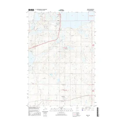
2016 Map of Spicer
USGS Topo · Published 2016About this map
Green Lake and Nest Lake anchor the northern landscape of this region, where the town of Spicer serves as a lakeside hub. The terrain is defined by a dense concentration of water bodies including Eagle Lake, Elkhorn Lake, and the expansive Alvig Slough, reflecting the glacial legacy of Kandiyohi County. To the south, the settlement of Kandiyohi sits along a straight corridor of transportation and agriculture, centered near Pacific Ave and McLaughlin Ave.
Find a feature on this map
61 named features on this map. Tap any name to fly to it.
Don’t see what you’re looking for? This feature index may not catch every label — zoom into the map to look around manually.
Map Details
Editions of this 2016 Spicer Map
This is the sole edition of this map. No revisions or reprints were ever made.
Other maps of this area

1953 · Saint Cloud
USGS Topo · 1:250,000

1956 · Atwater
USGS Topo · 1:62,500

1957 · Saint Cloud
USGS Topo · 1:250,000

1958 · Saint Cloud
USGS Topo · 1:250,000

1958 · Willmar
USGS Topo · 1:24,000

1958 · Solomon Lake
USGS Topo · 1:24,000

1967 · Mount Tom
USGS Topo · 1:24,000

1967 · Hawick
USGS Topo · 1:24,000
1967 · New London
USGS Topo · 1:24,000
1982 · Lake Elizabeth
USGS Topo · 1:24,000