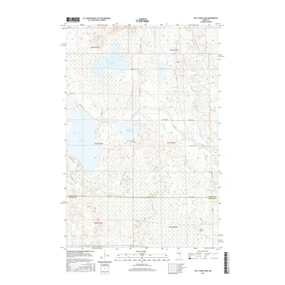
2016 Map of Split Hand Lake
USGS Topo · Published 2016About this map
Mississippi River oxbows and marshlands dominate the eastern edge of this landscape where Itasca Co and Aitkin Co meet. The 2016 terrain is defined by a complex glacial drainage system, featuring larger bodies of water like Split Hand Lake and Cow Horn Lake alongside smaller basins such as Little Split Hand Lake and Mud Lake. These lakes are interconnected by waterways including Split Hand Cr, which winds through a dense network of wetlands. Small-scale aviation and local infrastructure are visible through the presence of Porter Airport and a grid of rural routes such as Splithand Rd and Cow Horn Lake Rd. The map illustrates a rural Minnesota wilderness where historical land divisions like t53n r24w define the boundaries of timber and wetland tracts.
Find a feature on this map
33 named features on this map. Tap any name to fly to it.
Don’t see what you’re looking for? This feature index may not catch every label — zoom into the map to look around manually.
Map Details
Editions of this 2016 Split Hand Lake Map
This is the sole edition of this map. No revisions or reprints were ever made.
Other maps of this area

1953 · Grand Rapids
USGS Topo · 1:24,000

1953 · Duluth
USGS Topo · 1:250,000

1954 · Hibbing
USGS Topo · 1:250,000

1957 · Hibbing
USGS Topo · 1:250,000

1958 · Hibbing
USGS Topo · 1:250,000

1958 · Duluth
USGS Topo · 1:250,000

1964 · Hibbing
USGS Topo · 1:250,000

1969 · La Prairie
USGS Topo · 1:24,000
1970 · Warba
USGS Topo · 1:24,000

1970 · Split Hand Lake
USGS Topo · 1:24,000