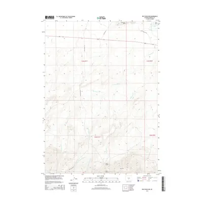
2015 Map of Split Rock NW
USGS Topo · Published 2015About this map
Sweetwater Rocks and the southern flow of the Sweetwater River define this high-altitude landscape in Fremont County. The map details a complex network of water management and natural drainage, from the Mcintosh Beaton Ditch in the northeast to the intricate forks of Cottonwood Creek and Spring Creek further south. The terrain transitions from the open flats accessed by Agate Flat Road toward the more varied elevations of the Green Mountains and the Owl Hills. Geologists and researchers can trace the course of Rocky Canyon and identify prominent landmarks like Dam Rock along the river. The lack of concentrated settlements highlights the area's character as a working ranching and range landscape, crossed by essential routes like Green Mountain Road.
Find a feature on this map
21 named features on this map. Tap any name to fly to it.
Don’t see what you’re looking for? This feature index may not catch every label — zoom into the map to look around manually.
Map Details
Editions of this 2015 Split Rock NW Map
This is the sole edition of this map. No revisions or reprints were ever made.
Other maps of this area

1951 · Crooks Creek NE
USGS Topo · 1:24,000

1951 · Stampede Meadow
USGS Topo · 1:24,000

1951 · Black Rock Gap
USGS Topo · 1:24,000

1951 · Split Rock
USGS Topo · 1:24,000

1951 · Split Rock NW
USGS Topo · 1:24,000

1951 · Lankin Dome
USGS Topo · 1:24,000

1955 · Casper
USGS Topo · 1:250,000

1957 · Jeffrey City
USGS Topo · 1:24,000

1958 · Casper
USGS Topo · 1:250,000

1961 · Crooks Peak
USGS Topo · 1:24,000