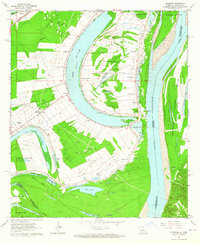
1963 Map of Spokane
USGS Topo · Published 1964About this map
Lake St John dominates the landscape of this river-front region, its oxbow curve defining the boundary between established agricultural lands and the active Mississippi River. The map captures a moment in the mid-20th century where large-scale landholdings like Alabama Plantation and Delhi Plantation still anchor the local geography, alongside smaller community centers such as Spokane. The presence of several Oil Field sites and scattered Drill Holes suggests a transition toward resource extraction amidst the traditional delta farming.
Find a feature on this map
53 named features on this map. Tap any name to fly to it.
Don’t see what you’re looking for? This feature index may not catch every label — zoom into the map to look around manually.
Map Details
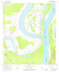
Editions of this 1963 Spokane Map
2 editions found
Other maps of this area

1909 · Sycamore Landing
USGS Topo · 1:24,000

1909 · Vidalia
USGS Topo · 1:24,000

1921 · Natchez
USGS Topo · 1:48,000

1922 · Natchez
USGS Topo · 1:62,500

1939 · Red Gum
USGS Topo · 1:62,500

1939 · Natchez
USGS Topo · 1:62,500

1939 · Locust Ridge
USGS Topo · 1:62,500

1941 · Sicily Island
USGS Topo · 1:62,500

1953 · Natchez
USGS Topo · 1:250,000

1956 · Natchez
USGS Topo · 1:250,000