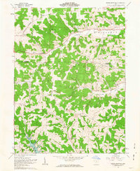
1962 Map of Spring Mountain
USGS Topo · Published 1963About this map
French Ridge and the deep valleys of Wolf Creek define the landscape of northwestern Coshocton County in the early 1960s. The area is characterized by scattered rural settlements like Stillwell and Spring Mountain, where the local economy and infrastructure are closely tied to the underlying geology. Numerous Strip Mines and Quarries dot the hillsides, particularly near the Holmes and Coshocton county line, while gas extraction is evidenced by a dense network of Gas Wells throughout the Richland and Killbuck townships.
Find a feature on this map
32 named features on this map. Tap any name to fly to it.
Don’t see what you’re looking for? This feature index may not catch every label — zoom into the map to look around manually.
Map Details
Editions of this 1962 Spring Mountain Map
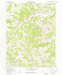
2 editions found
Other maps of this area

1912 · Loudonville
USGS Topo · 1:62,500

1913 · Brinkhaven
USGS Topo · 1:62,500

1913 · Coshocton
USGS Topo · 1:62,500

1914 · Loudonville
USGS Topo · 1:62,500

1915 · Brinkhaven
USGS Topo · 1:62,500

1915 · Millersburg
USGS Topo · 1:62,500

1915 · Coshocton
USGS Topo · 1:62,500

1943 · Millersburg
USGS Topo · 1:62,500

1943 · Coshocton
USGS Topo · 1:62,500

1943 · Loudonville
USGS Topo · 1:62,500