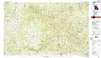
1986 Map of Spring Valley
USGS Topo · Published 1987About this map
The Current River and Jacks Fork serve as the central arteries of this Missouri Ozarks landscape, defining a region where conservation lands and small rural settlements exist in close proximity. Established state and national forests, including Hartshorn State Forest and the Mark Twain National Forest, cover large swaths of the terrain, illustrating the 1980s commitment to preserving the Missouri riverways. Amidst the dense woodland, local life centers on towns like Licking, Summersville, and Winona. The presence of the Burlington Northern railroad and the Adair Creek Mine points to the industrial and logistical connections that sustained these communities. For researchers, the map identifies specific local landmarks such as the New Hope Church and Munsell Cem, providing a detailed look at the rural social structure of the era.
Find a feature on this map
82 named features on this map. Tap any name to fly to it.
Don’t see what you’re looking for? This feature index may not catch every label — zoom into the map to look around manually.
Map Details
Editions of this 1986 Spring Valley Map
2 editions found
Other maps of this area

1915 · Eminence
USGS Topo · 1:62,500

1917 · Eminence
USGS Topo · 1:62,500

1924 · Edgehill
USGS Topo · 1:62,500

1926 · Edgehill
USGS Topo · 1:62,500

1928 · Cardareva
USGS Topo · 1:62,500

1931 · Bandyville
USGS Topo · 1:48,000

1932 · Cedar Grove
USGS Topo · 1:48,000

1937 · Edgar Springs
USGS Topo · 1:48,000

1939 · Topaz
USGS Topo · 1:62,500

1941 · Topaz
USGS Topo · 1:62,500