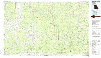
1986 Map of Spring Valley
USGS Topo · Published 1986About this map
Mark Twain National Forest dominates this mid-1980s landscape of the Missouri Ozarks, characterized by an extensive system of state forests and protected riverways. The Current River and Jacks Fork are protected as part of the Ozark National Scenic Riverways, showing a region dedicated to conservation and natural resource management. Small agricultural and timber communities like Licking, Summersville, and Mountain View serve as local hubs, while industrial activity is noted at the Fletcher Mine and Adair Creek Mine.
Find a feature on this map
120 named features on this map. Tap any name to fly to it.
Don’t see what you’re looking for? This feature index may not catch every label — zoom into the map to look around manually.
Map Details
Editions of this 1986 Spring Valley Map
2 editions found
Other maps of this area

1915 · Eminence
USGS Topo · 1:62,500

1917 · Eminence
USGS Topo · 1:62,500

1924 · Edgehill
USGS Topo · 1:62,500

1926 · Edgehill
USGS Topo · 1:62,500

1928 · Cardareva
USGS Topo · 1:62,500

1931 · Bandyville
USGS Topo · 1:48,000

1932 · Cedar Grove
USGS Topo · 1:48,000

1937 · Edgar Springs
USGS Topo · 1:48,000

1939 · Topaz
USGS Topo · 1:62,500

1941 · Topaz
USGS Topo · 1:62,500