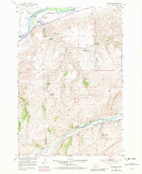
1951 Map of Springdale
USGS Topo · Published 1981About this map
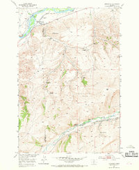
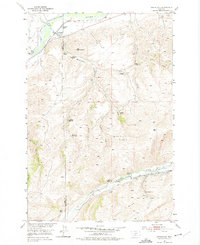
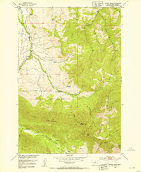
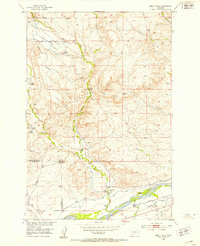
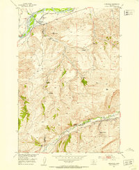
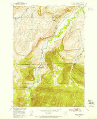
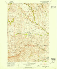
The Yellowstone River and its northern irrigation network anchor this 1951 survey, where the Hunters Hot Springs Canal and numerous flumes supported agricultural operations near the Springdale rail stop. This landscape is a detailed record of high-plains homesteading and ranching, tracing family names across both sides of the Park Co Sweet Grass Co boundary. Settlers such as the Olson Homestead, Swanson Homestead, and Mason Homestead are marked across the drainages of Hunters Creek and Chicken Creek. The presence of the Hash Homestead (Aban'd) near Mendenhall suggests the changing patterns of habitation as the 20th century progressed. To the south, the terrain rises toward the Rim and the West Boulder River, where a Coal Mine indicates the small-scale industrial activity once present in these foothills.
Find a feature on this map
36 named features on this map. Tap any name to fly to it.
Don’t see what you’re looking for? This feature index may not catch every label — zoom into the map to look around manually.
Map Details
Editions of this 1951 Springdale Map
4 editions found
Other maps of this area

1891 · Livingston
USGS Topo · 1:250,000

1893 · Livingston
USGS Topo · 1:250,000

1947 · Bozeman
USGS Topo · 1:250,000

1948 · Bozeman
USGS Topo · 1:250,000
1951 · Mount Rae
USGS Topo · 1:24,000
1951 · Squaw Peak
USGS Topo · 1:24,000
1951 · Kelly Hills
USGS Topo · 1:24,000
1951 · Springdale
USGS Topo · 1:24,000
1951 · Mc Leod Basin
USGS Topo · 1:24,000
1951 · Hunters Hot Springs
USGS Topo · 1:24,000