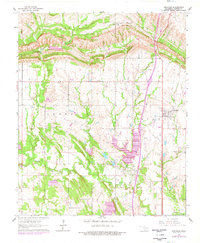
1964 Map of Springer
USGS Topo · Published 1978About this map
The southern slopes of the Arbuckle Mountains dominate the northern landscape of this Carter County quadrangle, where the terrain drops sharply toward the drainage basins of the south. At the foot of these elevations, Henry House Falls sits along Henry House Creek, near a large Quarry that signifies the area's industrial activity. To the south, the settlement of Springer serves as a local hub, situated near the headwaters of Buzzard Creek.
Find a feature on this map
19 named features on this map. Tap any name to fly to it.
Don’t see what you’re looking for? This feature index may not catch every label — zoom into the map to look around manually.
Map Details
Editions of this 1964 Springer Map
3 editions found
Other maps of this area

1901 · Ardmore
USGS Topo · 1:125,000

1918 · Ardmore
USGS Topo · 1:125,000

1957 · Ardmore
USGS Topo · 1:250,000

1963 · Ardmore
USGS Topo · 1:250,000

1964 · Ardmore East
USGS Topo · 1:24,000

1964 · Ardmore West
USGS Topo · 1:24,000
1964 · Gene Autry
USGS Topo · 1:24,000

1964 · Springer
USGS Topo · 1:24,000

1964 · Turner Falls
USGS Topo · 1:24,000
1965 · Dougherty
USGS Topo · 1:24,000