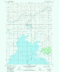
1955 Map of Springfield
USGS Topo · Published 1983About this map
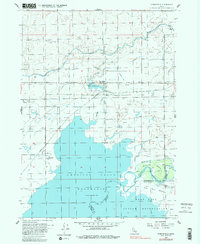
The American Falls Reservoir dominates the landscape south of the agricultural settlement at Springfield. This mid-century survey illustrates the intricate irrigation network essential to the high desert, including the Aberdeen Springfield Canal, Low Line Canal, and numerous laterals like Lateral C6 and Lateral D1. The convergence of these water systems near the Springfield Bird Haven creates a unique habitat contrast against the surrounding terrain. To the south, the Fort Hall Indian Reservation boundary meets the Snake River at the Fort Hall Bottoms, where the historic path of the Oregon Trail is noted alongside the Fort Hall Historic Monument. Further north, the Union Pacific railroad corridor serves the rural communities of Sterling and Springfield, connecting these remote outposts to the broader regional economy.
Find a feature on this map
31 named features on this map. Tap any name to fly to it.
Don’t see what you’re looking for? This feature index may not catch every label — zoom into the map to look around manually.
Map Details
Editions of this 1955 Springfield Map
3 editions found
Other maps of this area

1934 · American Falls
USGS Topo · 1:62,500

1934 · Michaud
USGS Topo · 1:62,500

1936 · American Falls
USGS Topo · 1:62,500

1937 · Michaud
USGS Topo · 1:62,500

1954 · Pocatello
USGS Topo · 1:250,000

1955 · Springfield NW
USGS Topo · 1:24,000

1955 · Rockford
USGS Topo · 1:24,000

1955 · Pingree
USGS Topo · 1:24,000

1955 · Springfield
USGS Topo · 1:24,000

1955 · Idaho Falls
USGS Topo · 1:250,000