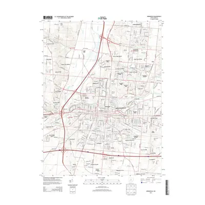
2013 Map of Springfield
USGS Topo · Published 2013About this map
The urban and suburban landscape of Springfield is defined by its strategic position at the confluence of the Mad River and Buck Creek. This modern survey reveals a dense network of neighborhoods such as Ridgewood, Kenwood Heights, and North Hill, alongside established institutions like Wittenberg Univ and Clark State Community College. The transportation corridor is dominated by the Norfolk Southern railway and the busy interchange of I-70 and Us 68. Historically significant sites are numerous, including the sprawling Ferncliff Cemetery and the Old Columbia Street Cemetery near the city center. To the west, the landscape transitions toward Lawrenceville and Snyders Mill, while the northeast is characterized by the expansive waters of the Clarence J. Brown Reservoir and the residential developments of Northridge.
Find a feature on this map
92 named features on this map. Tap any name to fly to it.
Don’t see what you’re looking for? This feature index may not catch every label — zoom into the map to look around manually.
Map Details
Editions of this 2013 Springfield Map
This is the sole edition of this map. No revisions or reprints were ever made.
Other maps of this area

1904 · Springfield
USGS Topo · 1:62,500

1906 · Springfield
USGS Topo · 1:62,500

1907 · South Charleston
USGS Topo · 1:62,500

1914 · St. Paris
USGS Topo · 1:62,500

1914 · Mechanicsburg
USGS Topo · 1:62,500

1916 · Mechanicsburg
USGS Topo · 1:62,500

1916 · St. Paris
USGS Topo · 1:62,500

1944 · Mechanicsburg
USGS Topo · 1:62,500

1944 · St. Paris
USGS Topo · 1:62,500

1947 · Columbus
USGS Topo · 1:250,000
Featured Places
- Springfield, OH
- Happy Valley Mobile Home Park, OH
- Limecrest, OH
- Beatty, OH
- Rose Garden Mobile Home Park, OH