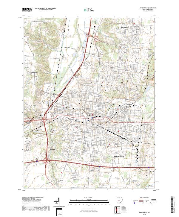
2023 Map of Springfield
USGS Topo · Published 2023About this map
The confluence of the Mad River and Buck Creek serves as the geographic heart of this area, anchoring the urban development of Springfield. This 2023 survey provides a contemporary perspective on the city's established neighborhoods and its northward expansion toward Northridge. The industrial and milling history of the region is reflected in place names like Snyders Mill and Lagonda, while the central business district is clearly defined by landmarks such as the Clark County Courthouse and the expansive grounds of Wittenberg University.
Find a feature on this map
340 named features on this map. Tap any name to fly to it.
Don’t see what you’re looking for? This feature index may not catch every label — zoom into the map to look around manually.
Map Details
Editions of this 2023 Springfield Map
This is the sole edition of this map. No revisions or reprints were ever made.
Other maps of this area

1904 · Springfield
USGS Topo · 1:62,500

1906 · Springfield
USGS Topo · 1:62,500

1907 · South Charleston
USGS Topo · 1:62,500

1914 · St. Paris
USGS Topo · 1:62,500

1914 · Mechanicsburg
USGS Topo · 1:62,500

1916 · Mechanicsburg
USGS Topo · 1:62,500

1916 · St. Paris
USGS Topo · 1:62,500

1944 · Mechanicsburg
USGS Topo · 1:62,500

1944 · St. Paris
USGS Topo · 1:62,500

1947 · Columbus
USGS Topo · 1:250,000