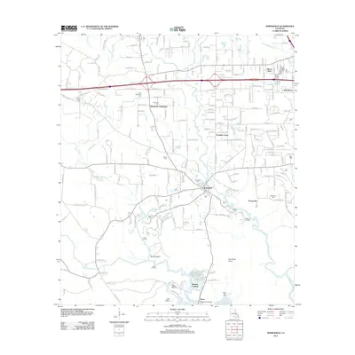
2012 Map of Springfield
USGS Topo · Published 2012About this map
The Hungarian Settlement defines the cultural landscape of this region north of the Natalbany River, marked by the Hungarian Cem and surrounding family homesteads. This area in Tangipahoa Parish shows a complex network of waterways, where the Blood River and Tickfaw River converge near the southern edge. The map reveals a transition from the structured street grids of Springfield and Pumpkin Center to the more agrarian reaches of Rosaryville. Genealogists will find significant value in the numerous burial sites and landings documented here, including Saint Margarets Cem, Galilee Cem, and Warsaw Landing. Landmarks like the Rome Ferry Bridge and the Booth Shell Bank near the river forks illustrate the historic reliance on these riparian corridors for local movement and industry.
Find a feature on this map
202 named features on this map. Tap any name to fly to it.
Don’t see what you’re looking for? This feature index may not catch every label — zoom into the map to look around manually.
Map Details
Editions of this 2012 Springfield Map
This is the sole edition of this map. No revisions or reprints were ever made.
Other maps of this area

1934 · Springfield
USGS Topo · 1:62,500

1935 · Ponchatoula
USGS Topo · 1:62,500

1939 · Ponchatoula
USGS Topo · 1:62,500

1939 · Springfield
USGS Topo · 1:62,500

1940 · Tickfaw
USGS Topo · 1:31,680

1949 · Albany
USGS Topo · 1:31,680

1950 · Doyle
USGS Topo · 1:31,680

1951 · Ponchatoula
USGS Topo · 1:62,500

1954 · Baton Rouge
USGS Topo · 1:250,000

1956 · Baton Rouge
USGS Topo · 1:250,000