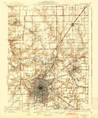
1930 Map of Springfield
USGS Topo · Published 1942About this map
The Springfield city center is shown in its pre-war density, radiating outward toward industrial and recreational anchors like the State Fair Ground and the newly formed Springfield Lake. To the north and east, the landscape is defined by the winding Sangamon River and its intricate oxbows, including Horseshoe Lake and Cow Pond. This era captures the capital as a critical transportation nexus, where the Illinois Terminal and Chicago and Alton railroads intersect a burgeoning network of local stops.
Find a feature on this map
114 named features on this map. Tap any name to fly to it.
Don’t see what you’re looking for? This feature index may not catch every label — zoom into the map to look around manually.
Map Details
Editions of this 1930 Springfield Map
3 editions found

Other maps of this area

1907 · Springfield
USGS Topo · 1:62,500

1909 · Tallula
USGS Topo · 1:62,500

1911 · Lincoln
USGS Topo · 1:62,500

1913 · Lincoln
USGS Topo · 1:62,500

1922 · Divernon
USGS Topo · 1:62,500

1923 · Taylorville
USGS Topo · 1:62,500

1924 · Divernon
USGS Topo · 1:62,500

1924 · Waverly
USGS Topo · 1:62,500

1925 · Taylorville
USGS Topo · 1:62,500

1926 · Waverly
USGS Topo · 1:62,500