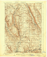
1925 Map of Springville
USGS Topo · Published 1931About this map
Cattaraugus Creek marks the southern edge of this survey, where the village of Springville serves as a principal hub for the surrounding rural townships of Concord and Sardinia. The topography is defined by the Boston Hills and the winding valleys of Cazenovia Creek and Hunter Creek, which shaped the early development of settlements like South Wales and Holland. This era captures a landscape dense with small district schools, such as the Hays Hollow School and Wheeler Hollow School, many of which were the civic anchors for rural families before consolidation.
Find a feature on this map
82 named features on this map. Tap any name to fly to it.
Don’t see what you’re looking for? This feature index may not catch every label — zoom into the map to look around manually.
Map Details
Editions of this 1925 Springville Map
5 editions found


Other maps of this area

1894 · Buffalo
USGS Topo · 1:62,500

1901 · Buffalo
USGS Topo · 1:62,500

1905 · Attica
USGS Topo · 1:62,500

1905 · Depew
USGS Topo · 1:62,500

1905 · Eden
USGS Topo · 1:62,500

1907 · Eden
USGS Topo · 1:62,500

1923 · Cattaraugus
USGS Topo · 1:62,500

1923 · Arcade
USGS Topo · 1:62,500

1924 · Ellicottville
USGS Topo · 1:62,500

1924 · Franklinville
USGS Topo · 1:62,500