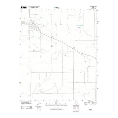
2010 Map of Spur
USGS Topo · Published 2010About this map
Spur sits at the junction of Dockum Creek and Duck Creek, serving as a centralized hub for the surrounding ranchlands of Dickens County. The town's grid is oriented diagonally along the former rail corridor, now marked by 6th St, showing a layout defined by early 20th-century transportation routes. To the east, the landscape transitions into the rolling terrain of the Steele Hills and the wide drainage of Spade Draw. Water management is a visible priority in this arid environment, evidenced by the Soil Conservation Service Site 12 Reservoir and its associated Soil Conservation Service Site 12 Dam north of Steele Hill. Further south, the map details the rural road network, including FM 261 and Airport Rd leading toward the Spur Municipal Airport, alongside numerous county roads that provide access to remote acreage and watercourses like Camp Creek and Wilson Draw.
Find a feature on this map
37 named features on this map. Tap any name to fly to it.
Don’t see what you’re looking for? This feature index may not catch every label — zoom into the map to look around manually.
Map Details
Editions of this 2010 Spur Map
This is the sole edition of this map. No revisions or reprints were ever made.
Other maps of this area

1954 · Lubbock
USGS Topo · 1:250,000

1959 · Gilpin
USGS Topo · 1:24,000

1959 · Girard
USGS Topo · 1:24,000

1967 · Dickens South
USGS Topo · 1:24,000

1967 · Spur
USGS Topo · 1:24,000

1967 · Spur NW
USGS Topo · 1:24,000

1968 · Foreman Chapel
USGS Topo · 1:24,000

1968 · Spur SW
USGS Topo · 1:24,000

1968 · White Camp
USGS Topo · 1:24,000

1968 · Croton Camp
USGS Topo · 1:24,000