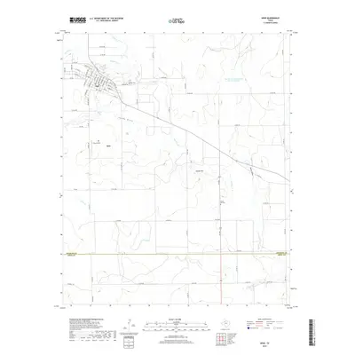
2019 Map of Spur
USGS Topo · Published 2019About this map
Spur serves as the primary hub of activity in this West Texas landscape, where the street grid of the town is bordered by the winding path of Duck Cr. This 2019 survey documents the transition between the organized residential blocks and the surrounding cattle-and-creek country. Local history is anchored by the Spur Cem just east of the town center and the Steele Hill Cem further south near the Steele Hills, markers of the area's long-term settlement. The terrain is defined by its drainage patterns, including Spade Draw and Wilson Draw, which move water toward the larger creek beds. Aviation is represented by Travis Field south of the main settlement, while infrastructure like the Soil Conservation Service Site 12 Reservoir points to modern efforts to manage the semi-arid environment's water resources.
Find a feature on this map
68 named features on this map. Tap any name to fly to it.
Don’t see what you’re looking for? This feature index may not catch every label — zoom into the map to look around manually.
Map Details
Editions of this 2019 Spur Map
This is the sole edition of this map. No revisions or reprints were ever made.
Other maps of this area

1954 · Lubbock
USGS Topo · 1:250,000

1959 · Gilpin
USGS Topo · 1:24,000

1959 · Girard
USGS Topo · 1:24,000

1967 · Dickens South
USGS Topo · 1:24,000

1967 · Spur
USGS Topo · 1:24,000

1967 · Spur NW
USGS Topo · 1:24,000

1968 · Foreman Chapel
USGS Topo · 1:24,000

1968 · Spur SW
USGS Topo · 1:24,000

1968 · White Camp
USGS Topo · 1:24,000

1968 · Croton Camp
USGS Topo · 1:24,000