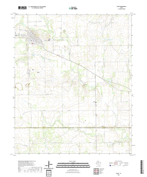
2022 Map of Spur
USGS Topo · Published 2022About this map
Spur serves as the primary hub in this West Texas landscape, where the town’s grid is defined by streets like N Parker Ave, Willard Ave, and Granite St. The map captures the transitional terrain south of the town center, where the residential blocks give way to the drainage systems of Duck Cr and Spade Draw. To the south, the Steele Hills rise above the confluence of seasonal waterways, marking a rugged break in the local topography. This area also contains significant genealogical landmarks, including the Spur Cem on the town's eastern edge and the more isolated Steele Hill Cem to the southeast. The survey also traces the jurisdictional line between Dickens County and Kent County, following the course of W Prong Duck Cr and Camp Cr as they move through the ranchlands of the south.
Find a feature on this map
71 named features on this map. Tap any name to fly to it.
Don’t see what you’re looking for? This feature index may not catch every label — zoom into the map to look around manually.
Map Details
Editions of this 2022 Spur Map
This is the sole edition of this map. No revisions or reprints were ever made.
Other maps of this area

1954 · Lubbock
USGS Topo · 1:250,000

1959 · Gilpin
USGS Topo · 1:24,000

1959 · Girard
USGS Topo · 1:24,000

1967 · Dickens South
USGS Topo · 1:24,000

1967 · Spur
USGS Topo · 1:24,000

1967 · Spur NW
USGS Topo · 1:24,000

1968 · Foreman Chapel
USGS Topo · 1:24,000

1968 · Spur SW
USGS Topo · 1:24,000

1968 · White Camp
USGS Topo · 1:24,000

1968 · Croton Camp
USGS Topo · 1:24,000