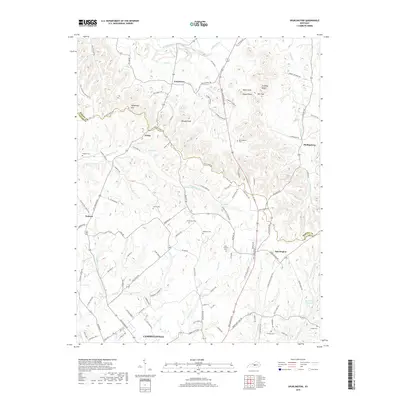
2019 Map of Spurlington
USGS Topo · Published 2019About this map
Muldraugh Hill and its dramatic ridges dominate the northern landscape of this region, providing a rugged backdrop to the small farming communities and family settlements of Taylor and Marion counties. In the rural valleys between Shingle Knob and Paine Knob, local life is centered around junctions like Jessietown, Finley, and Spurlington. The terrain is deeply etched by a network of waterways including Big Pitman Cr and Rolling Fork, which have historically shaped the development of transport and agriculture in the area.
Find a feature on this map
113 named features on this map. Tap any name to fly to it.
Don’t see what you’re looking for? This feature index may not catch every label — zoom into the map to look around manually.
Map Details
Editions of this 2019 Spurlington Map
This is the sole edition of this map. No revisions or reprints were ever made.
Other maps of this area

1952 · Mannsville
USGS Topo · 1:24,000

1952 · Bradfordsville
USGS Topo · 1:24,000

1953 · Campbellsville
USGS Topo · 1:24,000

1953 · Saloma
USGS Topo · 1:24,000

1953 · Lebanon East
USGS Topo · 1:24,000

1953 · Raywick
USGS Topo · 1:24,000

1953 · Spurlington
USGS Topo · 1:24,000

1953 · Lebanon West
USGS Topo · 1:24,000

1953 · Bradfordsville
USGS Topo · 1:24,000

1954 · Greensburg
USGS Topo · 1:24,000