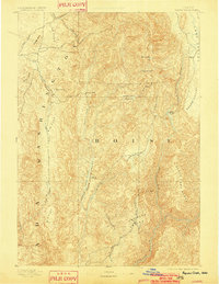
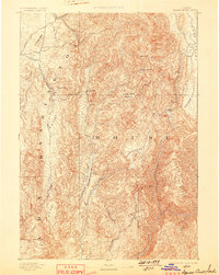
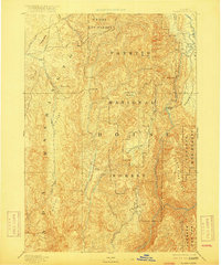
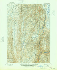
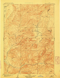
1894 Map of Squaw Creek
USGS Topo · Published 1902About this map
Smith Ferry and the isolated settlement of Ola serve as primary anchors in this early survey of the rugged interior between the Washington and Boise county lines. The landscape is defined by a series of high-altitude basins and distinct topographic corridors, including Upper Squaw Creek Valley, High Valley, and Sage Hen Valley. Industry and early pioneer infrastructure are represented by Walker Mill, while local landmarks like Hot Springs and Collyer Peak suggest the varied character of the terrain. The eastern edge is dominated by the North Fork Range, shielding Long Valley and Round Valley. This reconnaissance mapping, based on 1891 field work by A.H. Thompson, documents a time before significant infrastructure development, when the North Fork Payette River and small settlements like Alpha were the primary waypoints for travelers in these interior Idaho mountains.
Find a feature on this map
38 named features on this map. Tap any name to fly to it.
Don’t see what you’re looking for? This feature index may not catch every label — zoom into the map to look around manually.
Map Details
Editions of this 1894 Squaw Creek Map
5 editions found
Other maps of this area

1892 · Boise
USGS Topo · 1:125,000

1894 · Squaw Creek
USGS Topo · 1:125,000

1894 · Idaho Basin
USGS Topo · 1:125,000

1897 · Boise
USGS Topo · 1:125,000

1897 · Weiser
USGS Topo · 1:125,000

1898 · Nampa
USGS Topo · 1:125,000
1909 · Garden Valley
USGS Topo · 1:125,000

1911 · Meadows
USGS Topo · 1:125,000
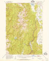
1953 · Smiths Ferry
USGS Topo · 1:62,500
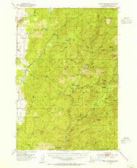
1953 · Boiling Springs
USGS Topo · 1:62,500