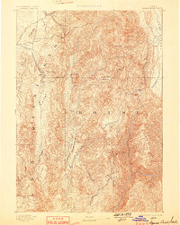
1894 Map of Squaw Creek
USGS Topo · Published 1898About this map
Smith Ferry serves as a vital crossing point on the Payette River in this late nineteenth-century reconnaissance of central Idaho. The landscape is defined by its deep drainage systems and high plateaus, such as the Lava Flat and Big Flat, which separate the rugged North Fork Range from the lower agricultural basins. Early settlement patterns are concentrated along water sources, where small outposts like Ola, Alpha, and Crane provide evidence of frontier development.
Find a feature on this map
34 named features on this map. Tap any name to fly to it.
Don’t see what you’re looking for? This feature index may not catch every label — zoom into the map to look around manually.
Map Details
Editions of this 1894 Squaw Creek Map
5 editions found
Other maps of this area

1892 · Boise
USGS Topo · 1:125,000

1894 · Squaw Creek
USGS Topo · 1:125,000

1894 · Idaho Basin
USGS Topo · 1:125,000

1897 · Boise
USGS Topo · 1:125,000

1897 · Weiser
USGS Topo · 1:125,000

1898 · Nampa
USGS Topo · 1:125,000

1909 · Garden Valley
USGS Topo · 1:125,000

1911 · Meadows
USGS Topo · 1:125,000

1953 · Smiths Ferry
USGS Topo · 1:62,500

1953 · Boiling Springs
USGS Topo · 1:62,500