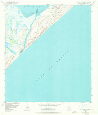
1952 Map of St. Charles Bay SE
USGS Topo · Published 1973About this map
Matagorda Island and St Joseph Island dominate this coastal survey, separated by the narrow passage of Cedar Bayou. The mid-century landscape is defined by its barrier island geography, where extensive Sand Dunes meet the vast Gulf of Mexico. On the landward side, the intricate network of Mud Flats and shallow waters such as Mesquite Bay and Vinson Slough illustrate the dynamic environment of the Texas Gulf Coast. Human activity in this remote stretch is sparse but specific, centered around the Wynne Ranch and Cedar Point. The presence of scattered Windmills and an isolated Oil Well speaks to the era's ranching and emerging mineral interests. The boundary between Aransas and Calhoun Counties cuts across the bay, marking administrative lines in a territory primarily shaped by wind and tide.
Find a feature on this map
15 named features on this map. Tap any name to fly to it.
Don’t see what you’re looking for? This feature index may not catch every label — zoom into the map to look around manually.
Map Details
Editions of this 1952 St. Charles Bay SE Map
4 editions found
Other maps of this area

1950 · Corpus Christi
USGS Topo · 1:250,000

1951 · Allyns Bight
USGS Topo · 1:24,000

1952 · St. Charles Bay SW
USGS Topo · 1:24,000

1952 · St. Charles Bay
USGS Topo · 1:24,000

1952 · Mesquite Bay
USGS Topo · 1:24,000

1952 · Panther Point
USGS Topo · 1:24,000

1952 · St. Charles Bay SE
USGS Topo · 1:24,000

1953 · Beeville
USGS Topo · 1:250,000

1956 · Corpus Christi
USGS Topo · 1:250,000

1956 · Beeville
USGS Topo · 1:250,000