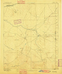
1892 Map of St Johns
USGS Topo · Published 1901About this map
St Johns stands as a central hub in this high-desert landscape, situated at the confluence of several early regional trails and the Little Colorado River. The terrain is defined by dramatic geological features, including the Petrified Forest and a Natural Bridge in the northwest, transitioning into the volcanic heights of Green Peak to the south.
Find a feature on this map
35 named features on this map. Tap any name to fly to it.
Don’t see what you’re looking for? This feature index may not catch every label — zoom into the map to look around manually.
Map Details
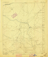
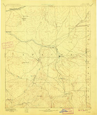
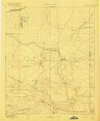
Editions of this 1892 St Johns Map
5 editions found
Other maps of this area

1883 · Tusayan
USGS Topo · 1:250,000

1886 · St Johns
USGS Topo · 1:250,000

1886 · Wingate
USGS Topo · 1:250,000

1886 · Tusayan
USGS Topo · 1:250,000

1886 · Fort Defiance
USGS Topo · 1:250,000

1886 · Holbrook
USGS Topo · 1:250,000

1892 · Fort Defiance
USGS Topo · 1:250,000

1892 · St Johns
USGS Topo · 1:250,000

1892 · Wingate
USGS Topo · 1:250,000

1893 · Holbrook
USGS Topo · 1:250,000